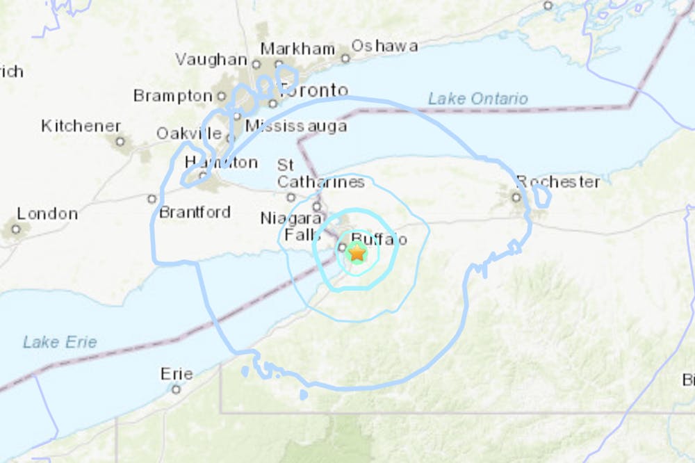
A 3.8 magnitude earthquake hit West Seneca, a town in Erie county, at 6:15 a.m. Monday. The earthquake was felt by towns upward of 30 miles away, and could be felt on all three of UB’s campuses.
USGS, the National Earthquake Center, released a graphic showing the intensity of the earthquake. According to USGS, an aftershock is unlikely to occur from this quake due to its small magnitude.
Earthquakes Canada was the first to initially report the earthquake Monday morning, registering it at a 4.2 magnitude.
The last earthquake reported in the Buffalo area was on May 19, 2020, in Wanakah, NY. The earthquake had a 2.3 magnitude on the seismic scale.
Earthquakes in Western New York aren’t unheard of. Research by UB geology professor Robert D. Jacobi found that “upstate New York is criss-crossed by faults.” Jacobi and his team identified potential fault lines using remote sensing by satellite and low-flying planes and found that there are “hundreds of faults throughout the Appalachian Plateau, some of which may have been seismically active — albeit sporadically — since Precambrian times, about 1 billion years ago,” according to a UB press release from 2000. There have been somewhat frequent earthquakes in the Niagara-Attica Zone since the first one was recorded in 1840, according to USGS’s tectonic summary.
“Only a few earthquakes in the zone [Niagara-Attica] can be linked to named faults,” the summary says. “It is difficult to determine if a known fault is still active and could slip and cause an earthquake. Numerous smaller or deeply buried faults may remain undetected.”
More information about earthquake measurements can be found here.
Victoria Hill is the senior news editor and can be reached at victoria.hill@ubspectrum.com
Kiana Hodge is a news editor and can be reached at kiana.hodge@ubspectrum.com


